3. Flood Damage Reduction
Bigger and more frequent floods
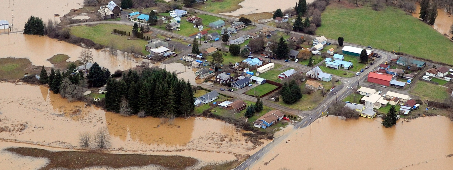
Floods are a normal part of life in the Chehalis Basin. However, the last 40 years have seen six of the largest flood events on record. As many remember, the region experienced two particularly devastating floods in 2007 and 2009 which destroyed homes and farms, killed livestock, and inundated businesses and infrastructure, including I-5, which was closed for several days. The 2007 alone caused over $900 million worth of damages – not to mention the emotional toll on basin residents.
It is clear that the frequency and extent of flooding has changed. Scientists predict this trend will continue.
Local flood protection and preparedness already in place
Since those catastrophic floods, local flood protection and preparedness investments across the Chehalis Basin have helped reduce flood-related damage and prepare the region for future flood risks. This progress has been achieved in large part through two Chehalis Basin Strategy-supported entities — the Chehalis River Basin Flood Authority, and the Community Assistance and Flood Resilience (CFAR) Program.
Chehalis River Basin Flood Authority
Established shortly after the 2007 flood, the Chehalis River Basin Flood Authority (Flood Authority) is made up of 13 basin jurisdictions that share a mission to reduce flood hazards and minimize adverse impacts to people, property, and the environment. The Chehalis Basin Board and OCB depend on a strong partnership with the Flood Authority — in fact, three of the seven voting Board members are appointed by the Flood Authority. Its primary roles are to:
- Administer locally driven projects that reduce flood-related impacts throughout the basin — over 100 since 2008
- Oversee the Chehalis River Basin Flood Warning System to provide critical safety alerts to basin residents
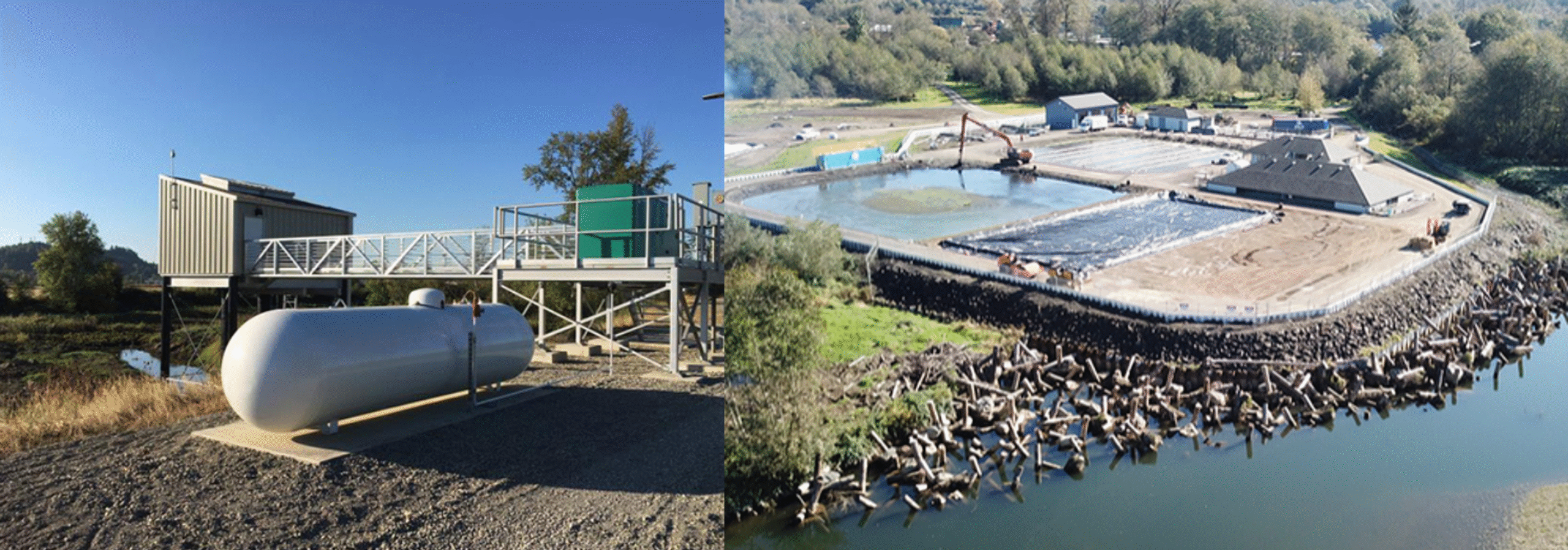
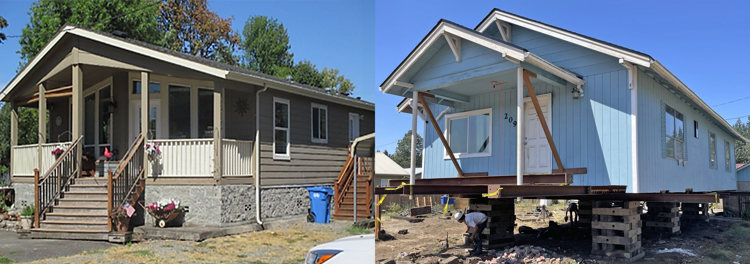
Local projects include engineered flood protection technologies that remove flood waters from priority areas and protect infrastructure, including the pump station at the Chehalis Centralia Airport (above left) and the Montesano Wastewater Treatment Plant project (above right). They also include floodproofing efforts to keep flood waters from damaging homes, farm pads to protect farm livelihoods, and erosion management projects using bioengineering to slow erosion and prevent land structures from being washed away.
Community Flood Assistance and Resilience (CFAR) Program
Administered by OCB, the Community Flood Assistance and Resilience (CFAR) Program provides technical and financial assistance for a wide range of small-scale projects and actions to reduce flood-related damage in communities throughout the basin. Anyone, including homeowners, renters or businesses living or operating in the Chehalis Basin, may be eligible for CFAR’s flood damage reduction assistance. CFAR can help:
- Explain flood insurance policies and rates
- Identify options for protecting your home, business, or community assets, e.g., structural elevations
- Provide financial assistance or identifying other funding sources to protect buildings and valuable items
CFAR also supports Tribal and local governments by offering technical assistance related to floodplain management regulations, technical neighborhood analyses, Community Rating System (CRS) support, and identifying funding opportunities for flood damage reduction projects.
Are you signed up for flood warning alerts?
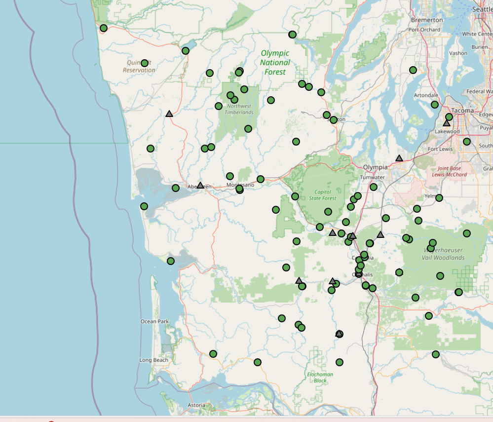
The Chehalis River Basin Flood Warning System provides critical safety alerts to basin residents. Visit chehalis.onerain.com to sign up for alerts in your area. To sign up for flood alerts, simply select the relevant icon and submit an online request form with you name and preferred email address. To explore the gages and stations managed by the Flood Authority, use the link here to access an interactive version of the map previewed below.
Looking to protect your home or business?
To request help from OCB’s CFAR program, submit an electronic request through the online portal. Advisors will contact you to review your situation and discuss options, explain the financial assistance program, help with any necessary documentation, and schedule a potential site visit to the property. In the meantime, you can also check out these quick guides to get you started:
- Flooding Prep Checklist (English/Español)
- Flood Insurance Frequently Asked Questions (English/Español)
- More on Resources for Basin Residents (English/Español)
The Aberdeen-Hoquiam Flood Protection Project
In the lower basin, the cities of Aberdeen and Hoquiam have partnered to protect their communities with two levees: the North Shore Levee and the North Shore-Levee West Segment. Once completed, these levees will protect over 3,000 properties, encourage economic vitality, and could save homeowners and businesses an estimate $2.2 million annually in required FEMA flood insurance premiums.
")
The cities are on track to utilize the full $17 million appropriation from the 2025-27 Washington State Legislature capital budget, in addition to appropriated grant funds from the federal government (though the status of those funds is uncertain). The North Shore Levee – West will be ready to bid construction by late 2025. The North Shore Levee will complete design, permitting and right of way for construction starting in 2028.
Long-term investments in flood damage reduction
Funding for the Flood Authority, the CFAR program, and other floodplain management, land use, and transportation planning will continue regardless of what the long-term Chehalis Basin Strategy shapes up to be. Investments to date have provided benefits across the basin, but larger-scale, longer-term flood protection measures are still needed to protect the basin’s communities, preserve some of the state’s most important industries, and maintain vital transportation corridors.
Read on to learn more about the long-term options the Board is considering.